
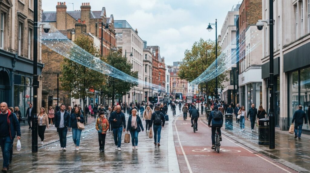
Sample-based estimates and manual clicker tallies can miss up to 30% of real footfall during peak surges, yet high-stakes urban regeneration decisions are still routinely based on them. Capturing verifiable, continuous city center pedestrian counts shouldn’t depend on guesswork or favourable weather. Instead, reliable urban mobility planning requires automated, calibrated sensing that monitors streetscapes around the clock without compromising public privacy.
If you’ve struggled with adverse weather distorting optical hardware, felt uncertain about UK GDPR regulations for outdoor sensors, or found it difficult to integrate footfall volume into broader transport frameworks, you aren’t alone. Balancing civic accountability with accurate active travel data is a complex operational challenge. In this guide, you’ll discover how to plan, collect, and analyse accurate city centre pedestrian counts whilst ensuring strict UK GDPR compliance through privacy-by-design edge processing. We’ll examine how to select robust 3D stereoscopic technology for open streets, eliminate environmental data drift, and turn raw pedestrian telemetry into defensible urban mobility models.
Key Takeaways
- Replacing episodic manual tallies with automated city center pedestrian counts establishes a continuous, defensible baseline for active travel schemes and town centre regeneration.
- Advanced 3D stereoscopic optical counters provide up to 99% accuracy via local edge processing, satisfying UK GDPR standards without capturing or storing personal data.
- Conducting a structured spatial audit ensures optimal cordon line placement and prevents common mounting errors caused by variable street lighting, foliage, and structural overhangs.
- Normalising footfall metrics against meteorological data and seasonal anomalies transforms raw hourly volumes into reliable indicators of high-street vitality and public realm usage.
- Long-term data integrity requires automated sensor health monitoring and ruggedised IP65/IP66 enclosures, with technical planning support accessible via Smart Urban Sensing or directly at sales@smarturbansensing.co.uk.
Understanding City Centre Pedestrian Counts and Urban Footfall Dynamics
Urban thoroughfares function as dynamic networks rather than static conduits. In technical terms, modern city center pedestrian counts refer to continuous, automated temporal tallies across public spaces, capturing the movement, direction, and pace of civic life. Establishing verifiable baseline metrics requires moving past isolated snapshot counts. Decades of standard civil engineering demonstrate that classical traffic counting methodologies, which were originally built around vehicular movements, fail to capture the nuanced ebb and flow of non-motorised active travel.
A critical technical distinction exists between gross footfall volume and point-in-time pedestrian density. Gross volume represents the cumulative headcount passing an established cordon line over an hour or a full day. Conversely, pedestrian density evaluates the concentration of individuals occupying a specific square area at any given moment. Evaluating both parameters simultaneously is vital for active travel safety, commercial vitality assessments, and civic crowd control.
To see how tracking human movement influences modern master planning and urban spatial dynamics, watch this insightful presentation:
Defining Baseline Footfall Metrics Across Core Urban Zones
Baseline parameters vary significantly depending on the operational zone. Retail high streets depend on steady directional flow rates and extended dwell times, indicating active commercial engagement. Transport interchanges present aggressive, sharp volume peaks clustered around commuter timetables. To detect spatial pinch points, planners compute Peak Hour Factors (PHF), comparing peak fifteen-minute surges against total hourly flows. Identifying these ratios ensures that civic squares and streetscapes accommodate sudden surges without compromising pedestrian safety.
The Strategic Role of Pedestrian Density in Public Infrastructure
Defensible pedestrian data underpins major infrastructural capital allocations. Verifiable volumes justify controversial scheme approvals, such as converting vehicular lanes to widened footpaths or pedestrianising shopping streets. Dynamic crowd density monitoring enables immediate intervention by municipal teams during civic celebrations, mitigating dangerous overcrowding. Integrating live footfall telemetry into long-term active travel frameworks provides local authorities with clear evidence to support national decarbonisation targets.
Deploying automated monitoring infrastructure requires experienced technical oversight. Local authorities and planning teams can consult with Smart Urban Sensing or speak with our planning specialists directly at sales@smarturbansensing.co.uk to design a compliant pedestrian monitoring framework.
Evaluating Counting Technologies: Manual Surveys vs Automated Sensor Systems
Selecting the right instrumentation dictates whether urban pedestrian monitoring yields defensible data or costly ambiguity. While manual surveyors once formed the backbone of audits, they don’t capture round-the-clock behavioural shifts. Technical standards such as the FHWA Traffic Monitoring Guide emphasise continuous observation over episodic tallies. Gathering verifiable city center pedestrian counts requires robust, automated systems that withstand dynamic street conditions, variable lighting, and pedestrian clustering without degrading baseline accuracy.
Limitations of Manual Tallies and Legacy Infrared Beams
Manual clipboards and handheld clickers introduce significant observer fatigue, dropping accuracy to between 70% and 90% during peak surges. Similarly, horizontal infrared break-beam systems struggle across wider urban footpaths. When two or more people walk abreast, the beam registers a single obstruction, causing severe undercounting. Extrapolating these compressed sample counts across annual planning models compounds errors and misrepresents true footfall distribution.
Precision Engineering: 3D Stereoscopic Sensors and Thermal Imaging
Modern automated networks rely on sophisticated overhead sensing. Dual-lens stereoscopic devices generate real-time 3D depth maps, calculating exact volumetric profiles. This spatial mapping separates human pedestrians from objects like shopping carts, luggage, and pushchairs, filtering out ground shadows and streetlamp glare. Thermal imaging provides supplementary resilience in adverse weather, yet specialised high precision 3D counters deliver up to 99% counting accuracy across dense, bi-directional crowds.
Privacy by Design: Navigating UK GDPR and Data Ethics
Public sensor infrastructure demands uncompromising data ethics. Unlike legacy video surveillance, privacy-first 3D optical devices utilise edge AI processors to calculate coordinates directly within onboard memory. Visual feeds are discarded instantly, transmitting only anonymised numerical telemetry to satisfy strict UK GDPR mandates without storing identifiable facial features. Conversely, passive Wi-Fi and Bluetooth probe sniffing have become unreliable, as mobile operating system MAC address randomisation reduces detection accuracy to roughly 60% to 75%.
To evaluate which optical sensors or outdoor counters best match your civic infrastructure, explore deployment options through Smart Urban Sensing or contact our technical team directly at sales@smarturbansensing.co.uk.
How to Implement a Pedestrian Counting Programme: A 5-Step Guide
Executing an urban monitoring strategy requires moving from theoretical network design to practical field engineering. Establishing baseline city center pedestrian counts demands structured planning to ensure hardware captures uncompromised spatial movement. A disciplined five-step deployment programme bridges the gap between field hardware and civic data models.
Step 1 & 2: Spatial Auditing and Sensor Specification
Begin by conducting an exhaustive spatial audit of civic thoroughfares. Map natural pedestrian desire lines, public transport pinch-points, and primary retail conduits alongside secondary arterial routes. This mapping identifies where cordon lines should sit to capture true throughput rather than circulatory wandering.
Match environmental constraints to appropriate hardware specifications. Key variables include:
- Mounting elevation and angles: Overhead positioning between 3.5 and 7 metres on civic lighting columns or building facades provides optimal stereoscopic visibility.
- Lux levels and climate: Open streetscapes require ruggedised outdoor counters rated to at least IP65 to withstand driving rain, vehicle grit, and extreme glare.
- Power topology: Determine whether devices will draw power via Power-over-Ethernet (PoE), dedicated mains feeds, or integrated solar battery systems.
Step 3 & 4: Sensor Mounting, Calibration, and Validation
Mount hardware securely using vibration-resistant brackets that withstand high winds. Once installed, engineers configure virtual detection lines within the device interface. These lines trace crossing gates across pavements, segregating bi-directional volumes whilst applying dwell-time thresholds to filter out loitering individuals or street performers.
System validation follows initial calibration. Run multi-hour control audits comparing automated logs against timestamped video control samples across both peak and off-peak conditions. Validating initial telemetry guarantees that data feeding into broader active travel models maintains defensible precision from day one.
Step 5: Telemetry Setup and Analytics Integration
Establish secure cellular 4G/5G or low-power wide-area network (LPWAN) backhaul connections to stream telemetry packets off-grid. Ingesting raw coordinates into a centralised platform, like V9 Analytics Software, allows planning authorities to automate spatial reporting, trigger real-time crowd alerts, and blend footfall patterns into wider traffic management frameworks.
For bespoke guidance on network architecture, hardware selection, and site planning, reach out directly to the Smart Urban Sensing contact team or speak to an engineer at sales@smarturbansensing.co.uk.

Transforming Raw Footfall Data into Actionable Urban Mobility Insights
Collecting raw figures solves only the operational half of the monitoring equation. Without contextual interpretation, gross city center pedestrian counts remain abstract digits rather than defensible assets for town planners. Turning thousands of hourly pedestrian vectors into evidence-based policy requires isolating ambient external variables, comparing civic baselines, and placing footfall alongside broader multimodal transit networks.
Normalising Footfall Against Weather, Events, and Seasonality
Pedestrian movements react sharply to external shocks. Heavy sustained rainfall or sudden cold snaps can depress open-street retail pedestrian volume, while public holidays, weekend street markets, or sporting matches trigger sudden artificial surges. Evaluating baseline commercial health without accounting for these variations skews active travel assessments.
Advanced platforms resolve this by applying regression layers to raw numbers:
- Meteorological correlation: Ingesting hyper-local rainfall and temperature feeds to calculate weather-adjusted baseline activity.
- Civic event indexing: Tagging planned street closures and festivals to separate scheduled footfall uplifts from underlying organic trends.
- Seasonal forecasting: Establishing quarter-on-quarter demand curves to help local authorities predict maintenance needs and lighting requirements across key civic zones.
Integrating Pedestrian Data with Multi-Modal Transport Systems
Pedestrian metrics should never sit inside an isolated operational silo. Cross-referencing footfall surges with smart junction monitoring systems allows municipal transport teams to adapt signal crossing phases dynamically during peak commuter hours, cutting pavement overcrowding. Similarly, evaluating active travel corridors requires correlating pedestrian densities alongside cycle lane usage tracking to identify modal shifts and balance street allocations.
Bringing these disparate data streams into unified platforms, such as V9 Analytics Software, connects discrete street-level numbers into comprehensive smart city footfall monitoring initiatives. Planners can visualise spatial trends across entire transport corridors in real time.
To integrate unified footfall analytics into your municipal planning framework, contact the Smart Urban Sensing team today or speak with our data specialists at sales@smarturbansensing.co.uk.
Best Practices for Urban Footfall Sensor Governance and Maintenance
Sustaining reliable urban sensing networks demands structured lifecycle governance. Even high-grade optical devices experience environmental wear over multi-year deployments. Preserving the integrity of continuous city center pedestrian counts requires municipal operators to balance proactive hardware maintenance with clear data ethics, preventing data drift and maintaining civic trust.
Hardware Health Checks and Remote Device Diagnostics
Automated telemetry diagnostics prevent undetected data gaps across street furniture networks. Centralised monitoring software, such as V9 Analytics Software, incorporates watchdog protocols to flag sudden anomalies, including unexpected power drops, packet transmission losses, or zero-count anomalies during peak operating hours.
Field maintenance schedules should address real-world street conditions:
- Optical enclosure cleaning: Traffic grime, diesel particulates, and spider webs degrade lens clarity. Enclosures certified to IP65 or IP66 standards protect sensitive internal components, yet scheduled lens cleaning remains necessary to ensure optical clarity.
- Foliage audits: Rapid seasonal canopy growth can obscure overhead sightlines. Quarterly checks ensure sight corridors remain clear of branch obstruction.
- Over-the-air firmware updates: Deploying neural network updates remotely refines edge-tracking algorithms and patches network security without requiring cherry-picker callouts.
Data Governance and Community Engagement
Clear communication regarding public realm data collection dispels civilian surveillance anxieties. Local authorities should place straightforward notices near monitored zones, stating that hardware performs anonymous spatial tracking at the edge without recording or storing personally identifiable visual feeds.
Transparency strengthens civic partnerships. Publishing aggregated, standardised pedestrian volumes through open public APIs allows regional universities, Business Improvement Districts (BIDs), and transport operators to assess high-street vitality independently. This shared intelligence supports evidence-based economic regeneration programmes without compromising public privacy.
For expert assistance with network deployment, ongoing maintenance frameworks, or technical hardware specifications, visit Smart Urban Sensing or send project specifications directly to sales@smarturbansensing.co.uk.
Architecting Data-Driven Public Spaces with Confidence
Defensible urban planning requires continuous, unassailable data rather than episodic estimations. By transitioning to automated infrastructure, local authorities capture continuous city center pedestrian counts that withstand public scrutiny and justify major active travel capital investments. Advanced 3D stereoscopic vision delivers up to 99% counting accuracy across crowded streetscapes, whilst non-intrusive edge processing ensures strict UK GDPR compliance by discarding video feeds locally and eliminating personal data exposure.
Paired with real-time telemetry via V9 Analytics Software, these continuous feeds turn isolated footfall vectors into predictive, verifiable mobility models. Whether evaluating public realm regeneration or balancing multi-modal junction phases, automated sensing establishes the empirical baseline needed for responsive civic management.
Ready to upgrade your municipal footfall monitoring? Discuss your urban sensing requirements with our technical team today or contact us directly at sales@smarturbansensing.co.uk to plan your deployment.
Frequently Asked Questions
How accurate are automated city centre pedestrian counts compared to manual surveys?
Automated 3D stereoscopic sensors deliver up to 99% accuracy, whereas manual surveyor tallies typically range between 70% and 90% due to observer fatigue and occlusion during busy surges. Continuous automated systems log footfall 24/7 across all seasons, eliminating the distortion caused by episodic sampling. Gathering continuous city center pedestrian counts digitally provides a verifiable, objective baseline that manual clickers and periodic clipboard tallies simply cannot replicate.
Do automated pedestrian counters capture personal data or violate UK GDPR?
Automated counters engineered with edge-processing architecture comply fully with UK GDPR. Optical systems like the AI 3DPro series convert visual feeds into anonymous coordinates and vector trajectories directly within onboard RAM. Video frames are discarded instantly rather than streamed or saved. Because no facial images, biometrics, or personal identifiers are retained or transmitted, the sensing process remains completely non-intrusive and privacy-compliant.
How do adverse weather conditions like rain and snow affect pedestrian counting accuracy?
Adverse weather frequently disrupts legacy 2D video cameras and simple infrared beams through surface reflections and obscured lenses. In contrast, purpose-built outdoor counters with ruggedised IP65 or IP66 enclosures protect sensitive hardware against heavy rain, road grit, and frost. Dual-lens 3D depth mapping tracks volumetric profiles rather than ground contrast, ensuring accuracy isn’t degraded by wet pavement reflections, falling snow, or sudden twilight lighting shifts.
Can pedestrian sensors distinguish between individual walkers, pushchairs, and groups?
Advanced 3D stereoscopic devices readily distinguish individual pedestrians walking abreast. By generating continuous three-dimensional height and volume maps, the onboard AI separates human heads and shoulders from objects such as prams, shopping trolleys, luggage, and pushchairs. This height-based filtering prevents inaccurate counts in congested areas, ensuring recorded city center pedestrian counts reflect genuine pedestrian volumes rather than wheeled street equipment.
What infrastructure is required to install pedestrian counters on urban street furniture?
Deploying outdoor pedestrian hardware requires stable mounting points such as lighting columns, building facades, or purpose-built masts at heights between 3.5 and 7 metres. Power can be provided through mains connections, Power-over-Ethernet (PoE), or integrated solar kits. Telemetry connects securely through cellular 4G/5G connections to transmit data directly into platforms like V9 Analytics Software without requiring local fixed cabling.
How do local authorities use pedestrian count data to improve public realm design?
Local authorities use continuous pedestrian volume data to assess footpath capacity, justify active travel scheme investments, and optimise pedestrian crossing clearance times. Defensible footfall records reveal commuter desire lines and highlight physical bottlenecks before permanent infrastructure schemes are constructed. They also measure how capital improvements, such as pedestrianisation or street greening, influence footfall vitality and civic dwell times across urban thoroughfares.
What is the difference between optical 3D stereoscopic counters and thermal imaging sensors?
Optical 3D stereoscopic counters use dual lenses to measure physical depth and height profiles, delivering up to 99% accuracy across densely packed crowds. Thermal sensors detect radiant heat signatures, excelling in darkness but experiencing reduced contrast when summer ambient outdoor temperatures approach human body temperature. For tailored hardware recommendations, consult Smart Urban Sensing or email our technical specialists at sales@smarturbansensing.co.uk.
Councils, BIDs and smart-city teams
Check what is practical before you go to tender
We review your count locations, mounting and power options, data needs and governance, and tell you what a robust pedestrian or public-realm monitoring scheme would look like.


