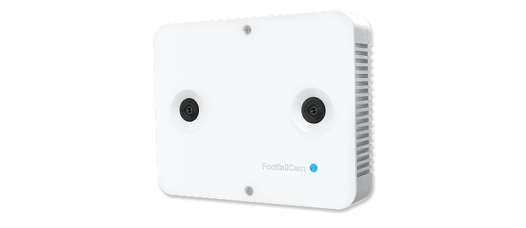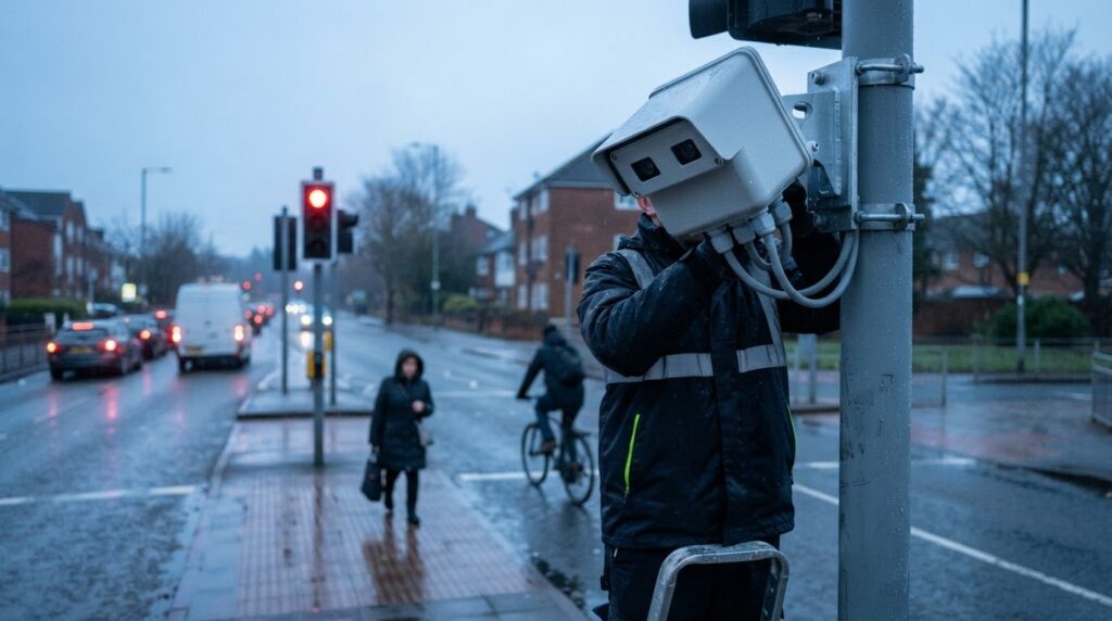
Sensor choice is a design decision, not just a hardware detail. Smart junction sensors monitor road users within an intersection, and cameras, radar and lidar each have different strengths. Cameras can recognise vehicle types well, radar is less affected by weather and lighting, and lidar can identify road-user types within the junction. The right approach depends on what needs to be detected and the conditions at the site.
It is understandable to focus first on detection performance, but reliable monitoring also depends on practical installation choices. Mounting position, enclosure design and operating temperatures all affect how equipment fits its environment and delivers useful data.
This article explains how cameras, radar and lidar differ, what to consider when positioning sensors, and how enclosures and temperature affect deployment. It also shows how these choices shape traffic monitoring, from detecting pedestrians and cyclists to collecting information that can support junction planning.
Key Takeaways
- Choose sensing methods around the road users and details you need to detect, since cameras, radar and lidar have different strengths.
- Plan sensor placement around the junction layout and the areas that need monitoring to support useful, consistent coverage.
- Match the enclosure and mounting approach to the installation environment, including exposure to weather and temperature changes.
- Use traffic data to inform junction planning and management, with the value depending on how well the measurements fit the decisions being made.
- For people-counting and smart-city monitoring solutions, contact Smart Urban Sensing through its contact page or email sales@smarturbansensing.co.uk.
Multi-modal traffic monitoring
Junction monitoring can combine information about vehicles, pedestrians and cyclists. The Smart Junction project uses lidar to detect road users within the area of one intersection.
Monitoring across traffic modes
Multi-modal traffic monitoring measures different types of road users at the same junction. This matters because a vehicle count alone cannot show how pedestrians and cyclists move through an intersection.
The Smart Junction project uses lidar to monitor traffic inside one intersection, including pedestrians and cyclists. Lidar can detect road-user types, but its range is shorter than radar’s, so defining the monitored area is important to system design. This broader picture can help transport planners consider interactions between modes, rather than treating each road user as an isolated count.
Comparing smart sensors with traditional detectors
Smart junction sensors use sensing technologies to classify or track road users, while traditional detectors commonly register a vehicle’s presence at a particular point. This difference matters when a transport team needs more than a count of vehicles passing a line.
A point detector can support a specific measurement, such as vehicle presence, but cannot by itself describe how different road users move through an intersection. A multi-modal setup can combine observations across the junction, helping analysts examine movement patterns. The practical distinction is the question being answered: detecting presence or understanding movement between approaches and crossings.
Detecting pedestrians, cyclists and emergency vehicles
Detection depends on a sensor’s ability to register and classify each road user within its field of view. The Smart Junction project uses lidar to detect road-user types, including pedestrians and cyclists, within an intersection.
Emergency-vehicle detection depends on the system recognising the relevant vehicle and communicating that information to the intended traffic-management process. A sensor alone does not establish priority. The detection method, classification and downstream signal arrangement all matter. For example, a system designed to distinguish cyclists from cars needs suitable coverage of the relevant approach and crossing.
UK compliance depends on the installation and the information collected. A project review should consider data protection where people could be identifiable, alongside requirements for highway equipment, electrical installations and connections to traffic signals. Data handling concerns the information collected, while equipment and infrastructure requirements concern how the installation operates at the junction. Applicable rules and standards depend on the system’s purpose, configuration and data flows.
Excitation monitoring is a separate electrical measurement: it checks the supply used to energise a sensor, such as a load cell. In the CRANE-BOY example, 75 mA remains for the load cells; that supply is sufficient for 2 load cells rated at 350 ohms each, but not for 4 such load cells. This illustrates why available excitation current must be considered alongside the number and electrical characteristics of connected sensors.
For a junction project, define the measurement before selecting the sensing arrangement. Vehicle counts, road-user classifications and movement through an intersection require different outputs. Map the approaches, crossings and areas of interest, then align sensor coverage and data processing with those needs. This gives the monitoring system a clear purpose and makes its traffic data more useful for planning.
Camera, radar and lidar sensors
No single sensor performs best in every junction condition. Cameras can recognise vehicle types better than radar, but provide less accurate speed and position data. Lighting can affect camera data, while radar is less affected by weather and lighting but less effective with slow-moving or small objects.
Lidar offers another option. It can detect road-user types within an intersection, but has a shorter range than radar. These differences affect what each system can measure reliably in a particular setting and help inform the technology choice for a site.
Privacy and cybersecurity risks depend partly on what the system captures and stores. Camera images may make people identifiable, while connected sensors and data systems can be vulnerable to unauthorised access. Limiting collected data and controlling system access help address these concerns.
What each sensor measures
A camera records visual information, which can support vehicle-type recognition and classification. Results can vary with lighting, so a shaded approach or changing illumination may affect the data available for analysis.
Radar measures movement using radio waves and is less affected by weather and lighting than cameras. However, it is less effective at detecting small or slow-moving road users, including pedestrians and cyclists. This distinction matters when monitoring activity near crossings.
Lidar uses laser measurements to identify objects and their positions within its monitored area. It can distinguish road-user types, although its range is shorter than radar’s. The choice depends on whether the priority is coverage, classification, speed or position, and how those measurements will inform junction decisions.
Reliability across conditions
Reliability depends on both the sensing method and the environment. A camera-based system, for example, may provide useful vehicle classification in suitable light, while changing illumination can affect its output. Radar is less affected by weather and lighting, but its weaker detection of small or slow-moving objects matters at pedestrian crossings.
No single accuracy figure applies to every junction or weather condition. Sensor performance depends on the target, positioning, coverage and environment. Combining complementary data can help address a method’s limitations, provided the system is designed around the intended measurements.
Privacy and system security
Data design matters as much as sensor choice. A camera may capture visual detail beyond what a traffic measurement requires, whereas a system configured to produce counts or classifications can focus analysis on movement information.
For connected equipment, access permissions, secure data handling and clear retention choices are relevant safeguards. These measures reduce unnecessary exposure without changing what the sensor detects. In the UK, projects involving information that could identify people should also consider applicable data-protection responsibilities.
For junction monitoring that brings sensing and mobility data together, discuss your requirements through junction monitoring consultations or email sales@smarturbansensing.co.uk.

Enclosure and mounting options
Mounting determines what a junction sensor can see and how securely it stays in position. An enclosure protects equipment, but its shape and location must also preserve the sensor’s field of view. For example, a camera aimed through a housing window needs an unobstructed view of its target area.
Choose a position around the monitored area
Start by defining the measurement area, such as a pedestrian crossing, cycle lane or vehicle approach. Mounting height and angle affect which parts of that area remain visible. A sensor directed too steeply towards the road may miss movement close to a crossing; one aimed across the junction may capture unwanted areas.
Nearby objects also affect placement. Traffic signs, signal poles, tree branches and roadside structures can obstruct a sensor or create blind spots. A branch growing across a camera’s view, for example, can gradually reduce the visible area. Reviewing the sightline from the proposed mounting point helps identify these issues before installation.
Mounting on a pole, mast or building requires a stable position with a clear view of the intended zone. Movement from a flexible support can shift the sensor’s alignment and change what it observes. The installation design should account for the support structure, cable route and access for maintenance.
Match the enclosure to the environment
Choose an enclosure suited to the sensor and its surroundings. Outdoor junction equipment may face rain, dust, direct sunlight and temperature changes. The housing must protect the equipment without blocking its sensing method: a camera needs a clear optical window, while other sensor types may require a different unobstructed surface.
Consider how the enclosure sheds water and where its openings are positioned. Poorly arranged cable entries can let moisture in, while an exposed window can collect dirt and degrade a camera’s view. Placing a housing beneath an overhang may reduce direct exposure, but the overhang must not obstruct the monitored area.
Material and finish matter too. A dark housing in direct sunlight may warm differently from a shaded one, and reflective surfaces can affect visibility around a camera. The surrounding street scene, mounting direction and access for cleaning all inform the enclosure choice.
Plan access and ongoing alignment
Plan maintenance access from the outset. A unit above a busy carriageway may be harder to inspect than one positioned on an accessible structure. The design should allow authorised maintenance teams to reach the enclosure safely and clean or realign it when needed.
Document the installed direction and monitored zone during commissioning. If roadworks later add a sign or change a crossing layout, that record helps teams assess whether the sensor still covers the intended area. A mounting review should consider the sensor, enclosure, support, sightline and future access together.
Operating and storage temperatures
Temperature planning involves two conditions: the range in which a sensor can operate and the conditions it can withstand in storage. At a UK junction, a unit mounted in direct summer sun may experience different conditions from one beneath a shaded structure. The enclosure, mounting position and sensor itself all influence the temperatures the equipment encounters.
Operating temperature refers to the environment around an active sensor. Heat can affect electronic components, while cold can influence start-up and the behaviour of some materials. For example, a sealed enclosure exposed to sunlight may become warmer than the surrounding air. Assess the actual mounting position, not just a general description of the local climate.
Storage temperature applies before installation or while equipment is kept off-site. A sensor stored in a vehicle, an unheated store or a warm plant room experiences different conditions in each case. Follow the manufacturer’s specified limits for storage. Moving equipment from a cold store into a warmer environment can also cause condensation, so allow it to acclimatise as directed before powering it.
For a junction installation, consider seasonal exposure as well as daily variation. A south-facing pole may receive direct sunlight in summer, while a shaded street can remain cooler. Rain, wind and the enclosure’s position can also influence local conditions. A single weather reading may not represent the environment at the sensor housing.
Installation planning can make temperature performance easier to manage:
- Record whether the proposed location receives direct sunlight, using the pole or building position as a reference.
- Review the equipment’s operating and storage limits before installation, and compare them with the expected site conditions.
- Consider how the enclosure and its mounting affect exposure, including whether nearby structures create shade or restrict airflow.
- Keep stored equipment in conditions that match its specified storage range, and follow handling guidance after temperature changes.
These checks matter because temperature can interact with other environmental factors. A sunlit enclosure, for example, may warm differently from a shaded one, even on the same street. A camera’s optical window needs to remain clear, while other sensor types depend on their own sensing surfaces and components. The enclosure should protect the unit without causing avoidable heat build-up or obstructing its sensing area.
During commissioning, confirm that the installed equipment is operating within its stated limits. If a sensor is moved, replaced or enclosed differently, reassess its exposure rather than assuming the original conditions still apply. A clear record of the location, enclosure and storage arrangements helps maintenance teams interpret later performance changes and plan inspections.
Traffic management and planning
Traffic data supports planning when it connects measured movement with a clear transport decision. In the UK, a Greater Cambridge Partnership pilot shows how sensor information can inform smart signal planning.
Benefits and drawbacks for road users
Smart junction sensors can help traffic teams understand how vehicles, pedestrians and cyclists use an intersection. For road users, better evidence can inform decisions about signal timing, crossing provision and cycle movements.
The benefit depends on how measurements are interpreted. A vehicle count alone, for example, cannot explain whether pedestrians face long waits or cyclists encounter conflict at a crossing. Data may also be incomplete when sensors have limited coverage or conditions affect detection. Traffic teams need to weigh these limits before changing junction operations.
For emergency vehicles, sensor information may support traffic-management decisions if the wider system is designed to act on detections. Detection itself does not guarantee priority or faster journeys. Measurements are most useful when matched to a defined operational purpose, such as assessing queues or reviewing crossing demand.
Use by UK cities and councils
In December 2020, the Greater Cambridge Partnership Executive Board approved delivery of a smart traffic signals pilot using the latest technology, including artificial intelligence. This is a specific UK example of planned sensor-enabled traffic management, rather than evidence that every junction across Cambridge uses the same system.
Cambridgeshire County Council has a target to achieve net zero carbon by 2045. That target provides wider local context for transport planning, but it does not itself establish sensor use at a particular junction. Clear distinctions between a target, an approved pilot and an operating installation help readers understand what each announcement means.
For road authorities, useful planning starts by linking a transport question to the data required. A council assessing pedestrian crossings may need movement information at crossing points, while a signal review may focus on approach flows and queues. Choose measures that reflect the decision, not simply the capabilities of available equipment.
Planning also requires considering how information will be used over time. A before-and-after comparison, for example, can help assess a change to signal operation, provided the data covers comparable conditions and the same monitored area. Reviewing coverage, data quality and operational context helps prevent a single count from being treated as a complete explanation.
Sensor projects are most useful when transport teams connect collection, interpretation and action. That means defining the planning objective, deciding which road-user movements matter, and considering how findings will inform junction design or management. To discuss junction monitoring requirements, contact the team at sales@smarturbansensing.co.uk.
Smart Urban Sensing
Smart Urban Sensing Ltd helps organisations plan junction and cycle-lane monitoring around their transport objectives. Its Smart Junctions & Cycle Lane Monitoring offering is relevant when a project needs data to understand movement across urban streets and support mobility planning.
For broader people-counting applications, AI 3DPro1 and AI 3DPro2 provide additional options within the company’s sensing range. The right solution depends on the site, the road users being monitored and the decisions the resulting data needs to inform.
To discuss your monitoring requirements, contact Smart Urban Sensing Ltd or email sales@smarturbansensing.co.uk.
Shape the next monitoring decision
Before specifying smart junction sensors, identify the transport decision the data should inform. A scheme might focus on movement through a crossing, cycle-lane use or how junction operation serves different road users. That purpose provides a practical basis for deciding what to monitor and how to assess whether the resulting information is useful.
Then bring the site context into the discussion: the monitored area, proposed mounting position, environmental exposure and intended use of the data. These considerations connect sensor selection with installation planning, rather than treating hardware as a standalone choice. A clear brief focuses the conversation on the requirements that matter to your scheme.
For a considered next step, Book a free 20-minute footfall review or email sales@smarturbansensing.co.uk to discuss your monitoring objectives. A well-defined starting point can help turn a complex junction challenge into a clear, actionable plan.
Frequently Asked Questions
What are smart junction sensors and how do they work?
Smart junction sensors collect information about movement through a road intersection. Depending on the system, they can identify road users, estimate movement or produce counts for transport analysis. A processing platform turns sensor readings into structured data, such as vehicle classifications or pedestrian movements. For example, a council could use this information to understand which approaches experience the greatest demand before reviewing its junction plans.
What types of sensors are used at smart road junctions?
Common options include cameras, radar and lidar, each of which measures the scene differently. Cameras record visual information, radar detects movement using radio waves, and lidar uses laser measurements to identify objects. Some systems combine methods so that one sensor’s output complements another’s. The suitable arrangement depends on the road users being measured, the coverage required and site conditions, not on using the same technology at every junction.
How do smart junction sensors control traffic lights and reduce congestion?
Sensors do not control traffic lights by themselves. They provide information that a compatible traffic-management system can use to adjust signal operation, depending on its configuration and objectives. For example, vehicle and pedestrian measurements could help a transport team assess whether signal timings reflect observed demand. Whether this reduces congestion depends on the junction layout, signal strategy and traffic conditions. Monitoring supports decisions, but does not guarantee shorter queues.
What UK laws and standards govern smart traffic sensors and junction data?
Projects should consider data-protection requirements where people could be identifiable, alongside requirements for highway equipment, electrical installations and connections to traffic signals. Applicable rules and standards depend on the system’s purpose, configuration and data flows.
Retail and shopping centres
Find out what your entrance data should be telling you
In 20 minutes we review your entrances, current counting setup and conversion questions, then tell you what accurate footfall data would change. No obligation, no hard sell.